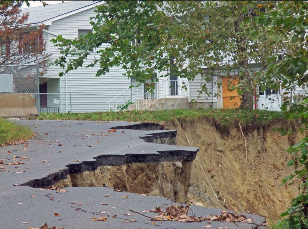
As we laid out in Part One of this blog series, the Moodna Creek Watershed, which covers 180 square miles of eastern Orange County, New York, has seen population growth in recent years and has experienced significant flooding from extreme weather events like Hurricane Irene, Tropical Storm Lee, and Hurricane Sandy. Reports indicate that the Moodna Creek Watershed’s flood risk will likely increase as time passes.
Understanding the existing and anticipated conditions for flooding within a watershed is a critical step to reducing risk. Our analysis revealed that flood risk in the Lower Moodna is predominantly driven by high-velocity flows that cause erosion, scouring, and damage to in-stream structures. The second cause of risk is back-flooding due to naturally formed and man-made constrictions within the channel. Other factors that have influenced flood risk within the watershed, include development within the floodplain and poor stormwater management.
Now, let’s take a closer look at a few of the strategies that we recommended for the Lower Moodna Watershed to address these issues and reduce current and future flood risk:
STORMWATER MANAGEMENT

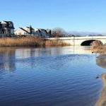
Damage to Butternut Drive caused when Moodna Creek flooded after Hurricane Irene (Courtesy of Daniel Case via Wikimedia Commons)
Stormwater is the runoff or excess water caused by precipitation such as rainwater or snowmelt. In urban areas, it flows over sewer gates which often drain into a lake or river. In natural landscapes, plants absorb and utilize stormwater, with the excess draining into local waterways. In developed areas, like the Moodna Creek watershed, challenges arise from high volumes of uncontrolled stormwater runoff. The result is more water in streams and rivers in a shorter amount of time, producing higher peak flows and contributing to flooding issues.
Pollutant loading is also a major issue with uncontrolled stormwater runoff. Population growth and development are major contributors to the amount of pollutants in runoff as well as the volume and rate of runoff. Together, they can cause changes in hydrology and water quality that result in habitat loss, increased flooding, decreased aquatic biological diversity, and increased sedimentation and erosion.
To reduce flood hazards within the watershed, stormwater management is a primary focus and critical first step of the Moodna Creek Watershed Management Plan. The recommended stormwater improvement strategies include:
· Minimizing the amount of impervious area within the watershed for new development, and replacing existing impervious surfaces with planter boxes, rain gardens and porous pavement.
· Utilizing low-impact design measures like bioretention basins and constructed-wetland systems that mimic the role of natural wetlands by temporarily detaining and filtering stormwater.
· Ensuring the long-term protection and viability of the watershed’s natural wetlands.
The project team recommended that stormwater management be required for all projects and that building regulations ensure development does not change the quantity, quality, or timing of run-off from any parcel within the watershed. Recommendations also stressed the importance of stormwater management ordinances focusing on future flood risk as well as addressing the existing flooding issues.
FLOODPLAIN STORAGE
Floodplains are the low-lying areas of land where floodwater periodically spreads when a river or stream overtops its banks. The floodplain provides a valuable function by storing floodwaters, buffering the effect of peak runoff, lessening erosion, and capturing nutrient-laden sediment.
Communities, like the Moodna Creek watershed, can reduce flooding by rehabilitating water conveyance channels to slow down the flow, increasing floodplain storage in order to intercept rainwater closer to where it falls, and creating floodplain benches to store flood water conveyed in the channel. Increasing floodplain storage can be an approach that mimics and enhances the natural functions of the system.
One of the major causes of flooding along the Lower Moodna was the channel’s inability to maintain and hold high volumes of water caused by rain events. During a significant rain event, the Lower Moodna channel tends to swell, and water spills over its banks and into the community causing flooding. One way to resolve this issue is by changing the grading and increasing the size and depth of the floodplain in certain areas to safely store and infiltrate floodwater. The project team identified several additional opportunities to increase floodplain storage throughout the watershed.

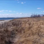
One of the primary areas of opportunity was the Storm King Golf Club project site (above). The team analyzed the topography of the golf course to see if directing flow onto the greens would alter the extent and reach of the floodplain thus reducing the potential for flooding along the roadways and properties in the adjacent neighborhoods. Based on LiDAR data, it was estimated that the alteration of 27 acres could increase floodplain storage by 130.5 acre-feet, which is equivalent to approximately 42.5 million gallons per event.
LAND PRESERVATION & CRITICAL ENVIRONMENTAL AREA DESIGNATION

For areas where land preservation is not a financially viable option, but the land is undeveloped, prone to flooding, and offers ecological value that would be impacted by development, the project team recommended a potential Critical Environmental Area (CEA) designation. A CEA designation does not protect land in perpetuity from development, but would trigger environmental reviews for proposed development under the NY State Quality Environmental Review Act. And, the designation provides an additional layer of scrutiny on projects to ensure they will not exacerbate flooding within the watershed or result in an unintentional increase in risk to existing properties and infrastructure.
Conserved riparian areas also generate a range of ecosystem services, in addition to the hazard mitigation benefits they provide. Protected forests, wetlands, and grasslands along rivers and streams can improve water quality, provide habitat to many species, and offer a wide range of recreational opportunities. Given the co-benefits that protected lands provide, there is growing interest in floodplain conservation as a flood damage reduction strategy.