The Amber Routes
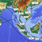
During the 2nd millennium BC, trade ways developed in Europe. One route, for example, ran between Italy and Spain via Marseille and nearby Heraclea, close to present-day Avignon, France. Such ways were used for the movement of flints from Denmark, freestone from Belgium, salt from Austria, lead and tin from England, and amber from northern Europe. By about 1500 BC many of the ways in eastern and central Europe had linked together into an extensive trading network known as the Amber Routes. Four routes have been identified, the first from modern Hamburg, Germany, southwestward by dual routes through Cologne and Frankfurt to Lyon and Marseille. The second also passed from Hamburg south to Passau on the Danube and then through the Brenner Pass to Venice. The third began at Samland on the East Prussian coast (where amber is still found), crossed the Vistula River at Thorn, and thence continued southeastward through the Moravian Gate to Aquileia on the Adriatic. The fourth, the Baltic-Pontus road, followed the main eastern rivers, the Vistula, Saw, Sereth, Prut, Bug, and Dnieper.
While the Amber Routes were not roads in the modern sense, they were improved at river crossings, over mountain passes, and across wet and swampy areas. A few remnants of these roads survive today. They were constructed by laying two or three strings of logs in the direction of the road on a bed of branches and boughs up to 20 feet (6 metres) wide. This layer was then covered with a layer of transverse logs 9 to 12 feet in length laid side by side. In the best log roads, every fifth or sixth log was fastened to the underlying subsoil with pegs. There is evidence that the older log roads were built prior to 1500 BC. They were maintained in a level state by being covered with sand and gravel or sod. In addition, the Romans used side ditches to reduce the moisture content and increase the carrying capacity.
The Roman roads
The greatest systematic road builders of the ancient world were the Romans, who were very conscious of the military, economic, and administrative advantages of a good road system. The Romans drew their expertise mainly from the Etruscans—particularly in cement technology and street paving—though they probably also learned skills from the Greeks (masonry), Cretans, Carthaginians (pavement structure), Phoenicians, and Egyptians (surveying). Concrete made from cement was a major development that permitted many of Rome’s construction advances.
The Romans began their road-making task in 334 BC and by the peak of the empire had built nearly 53,000 miles of road connecting their capital with the frontiers of their far-flung empire. Twenty-nine great military roads, the viae militares, radiated from Rome. The most famous of these was the Appian Way. Begun in 312 BC, this road eventually followed the Mediterranean coast south to Capua and then turned eastward to Beneventum, where it divided into two branches, both reaching Brundisium (Brindisi). From Brundisium the Appian Way traversed the Adriatic coast to Hydruntum, a total of 410 miles from Rome.
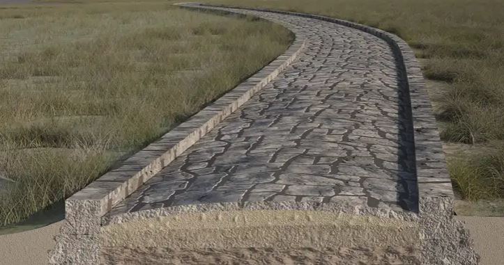
The typical Roman road was bold in conception and construction. Where possible, it was built in a straight line from one sighting point to the next, regardless of obstacles, and was carried over marshes, lakes, ravines, and mountains. In its highest stage of development, it was constructed by excavating parallel trenches about 40 feet apart to provide longitudinal drainage—a hallmark of Roman road engineering. The foundation was then raised about three feet above ground level, employing material taken from the drains and from the adjacent cleared ground. As the importance of the road increased, this embankment was progressively covered with a light bedding of sand or mortar on which four main courses were constructed: (1) the statumen layer 10 to 24 inches (250 to 600 millimetres) thick, composed of stones at least 2 inches in size, (2) the rudus, a 9-inch-thick layer of concrete made from stones under 2 inches in size, (3) the nucleus layer, about 12 inches thick, using concrete made from small gravel and coarse sand, and, for very important roads, (4) the summum dorsum, a wearing surface of large stone slabs at least 6 inches deep. The total thickness thus varied from 3 to 6 feet. The width of the Appian Way in its ultimate development was 35 feet. The two-way, heavily crowned central carriageway was 15 feet wide. On each side it was flanked by curbs 2 feet wide and 18 inches high and paralleled by one-way side lanes 7 feet wide. This massive Roman road section, adopted about 300 BC, set the standard of practice for the next 2,000 years.

ancient Rome
The public transport of the Roman Empire was divided into two classes: (1) cursus rapidi, the express service, and (2) agnarie, the freight service. In addition, there was an enormous amount of travel by private individuals. The two most widely used vehicles were the two-wheeled chariot drawn by two or four horses and its companion, the cart used in rural areas. A four-wheeled raeda in its passenger version corresponded to the stagecoaches of a later period and in its cargo version to the freight wagons. Fast freight raedae were drawn by 8 horses in summer and 10 in winter and, by law, could not haul in excess of 750 pounds (340 kilograms). Speed of travel ranged from a low of about 15 miles per day for freight vehicles to 75 miles per day by speedy post drivers.


Comments are closed