Posted inSurveying Vertical control Posted by admin August 9, 2021 INTRODUCTION This chapter describes the various heighting procedures used to obtain the elevation of points…
Posted inSurveying Basic concept of errors Posted by admin August 9, 2021 The basic concept of errors in the data captured by the surveyor may be likened…
Posted inSurveying Errors In Measurement Posted by admin August 9, 2021 It should now be apparent that position fixing simply involves the measurement of angles and…
Posted inSurveying Units Of Measurement Posted by admin August 9, 2021 The system most commonly used for the definition of units of measurement, for example of…
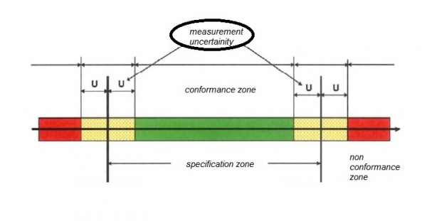
Posted inSurveying Error and uncertainty Posted by admin August 9, 2021 In surveying nothing is ever absolutely certain. The product of surveying may be thought of…
Posted inSurveying Plotting Detail Posted by admin August 9, 2021 In the past, detail would have been plotted on paper or a more stable medium…
Posted inSurveying Locating Position Posted by admin August 9, 2021 Establishing control networks and their subsequent computation leads to an implied rectangular coordinate system over…
Posted inSurveying Control Networks Posted by admin August 9, 2021 The establishment of two- or three-dimensional control networks is the most fundamental operation in the…
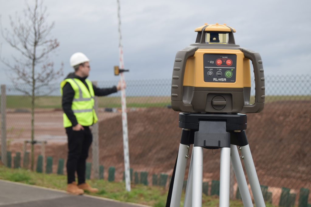
Posted inSurveying Levelling Posted by admin August 9, 2021 · It is a surveying method used to determine the level of points/objects with reference to…
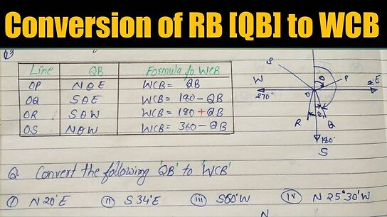
Posted inSurveying To find QB from WCB Posted by admin August 9, 2021 Solution : Line PA lies in 1st quadrant. Quadrant Bearing of PA = N 35o…