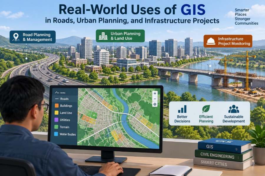

A road closure after heavy rain can look simple from the driver’s seat: a barricade, a detour sign, and a longer trip home. For an engineer or public agency, it raises a chain of location-based questions. Which culverts are nearby? Where has water collected before? Which neighbourhoods lose access, and where should inspection crews go first?
Those questions are difficult to answer from spreadsheets, drawings, and separate databases alone. They become far more manageable when information is connected to its real-world location on a map.
That is the practical strength of Geographic Information Systems, usually called GIS. GIS helps teams collect, organize, analyze, and communicate data that has a geographic position—from road assets and utility lines to population patterns, terrain, land ownership, and construction activity.
For civil engineers, GIS is not merely a map-making tool. Used carefully, it becomes a shared decision environment for planning, design, construction, operations, and emergency response.
🗺️ GIS: More Than a Digital Map
A GIS combines geographic data with descriptive information. A street line may carry attributes such as pavement type, lane count, posted speed, condition rating, last resurfacing date, and responsible maintenance unit.
The map is the visible interface, but the value lies in the relationship between where something is and what is known about it. A team can query every bridge within a flood-prone corridor, or identify water mains beneath a proposed road widening.
Unlike a static plan sheet, GIS data can be filtered, updated, analyzed, and shared among disciplines. It does not replace engineering drawings or calculations; it connects their context across a wider area.
📍 Why Location Changes Engineering Decisions
Infrastructure performs differently depending on location. A pavement section exposed to frequent heavy trucks, poor drainage, and freeze-thaw conditions faces different risks from an identical section on a lightly travelled urban street.
GIS makes these spatial relationships visible. Engineers can overlay traffic volumes, soils, slope, drainage paths, land use, crash records, and asset condition to see patterns that isolated tables may hide.
This is especially useful when a project has competing constraints. A preferred alignment may reduce travel time but cross unstable ground, affect protected land, conflict with utility corridors, or isolate local access. GIS helps identify these trade-offs early.
🧩 The Building Blocks of a GIS Dataset
Most GIS layers use points, lines, or polygons. A point may represent a manhole, signal pole, borehole, or crash location. A line may represent a road centerline, pipeline, stream, or sidewalk. A polygon may represent a parcel, floodplain, work zone, or land-use district.
Each feature has attributes stored in a table. The usefulness of the dataset depends on both geometry and attributes being reliable, current, and consistently defined.
- Spatial data describes position, shape, and extent.
- Attribute data describes properties such as material, age, owner, capacity, or inspection status.
- Metadata records who created data, when, how, and for what intended use.
Metadata is often overlooked, yet it tells users whether a layer is suitable for preliminary screening, field navigation, or detailed design.
🧭 Coordinate Systems and Accurate Alignment
Every GIS project needs an appropriate coordinate reference system. This system defines how Earth’s curved surface is represented on a flat map and how coordinates are measured.
A poorly chosen or inconsistently applied system can shift layers relative to one another. A utility line that appears clear of a proposed excavation may be misleading if source datasets use different datums, transformations, or survey quality.
For corridor design and construction staking, GIS coordinates should be handled in close coordination with survey control. GIS is excellent for integration and analysis, but it should not be assumed to provide survey-grade accuracy unless the data collection method and quality controls support that use.
🛣️ Building a Road Inventory
Road agencies need a reliable inventory before they can manage a network intelligently. GIS can link each road segment to its functional class, jurisdiction, lane configuration, surface material, condition, traffic data, and maintenance history.
Segmentation matters. If a long road changes from asphalt to concrete, from two lanes to four, or from good to poor condition, the inventory should reflect those meaningful changes rather than treating the entire road as one uniform feature.
A well-designed road inventory supports routine work such as locating assets, preparing budgets, answering public enquiries, and coordinating work across departments.
🚧 Selecting Road Corridors Before Detailed Design
During early route planning, GIS helps engineers compare broad corridor alternatives before committing to expensive surveys and detailed drawings. It can bring together terrain, land use, environmental constraints, existing transport links, settlements, parcels, and known utility networks.
For example, a hypothetical bypass may appear shorter on a base map but require extensive retaining structures across steep terrain. Another route may be slightly longer but follow gentler ground and connect more effectively to existing intersections.
The output should be treated as a screening tool, not final proof that an alignment is feasible. Ground investigation, traffic analysis, environmental review, land acquisition work, and detailed geometric design remain essential.
⛰️ Reading Terrain with Digital Elevation Models
A digital elevation model, or DEM, represents ground elevation across an area. GIS can derive slope, aspect, contours, ridgelines, drainage paths, and terrain profiles from a DEM.
These outputs support preliminary road grading, earthworks awareness, drainage planning, accessibility studies, and landslide screening. A steep-slope map can quickly identify sections where cut-and-fill quantities or stability concerns may become significant.
Terrain data has limits. Vegetation, buildings, resolution, and collection method can affect results. Engineers should verify whether a model represents bare earth or surface features and whether its resolution suits the decision being made.
🌧️ Mapping Drainage and Flood Exposure
Water is one of the most persistent threats to roads and urban infrastructure. GIS helps teams map catchments, flow paths, culverts, inlets, channels, low points, flood-prone areas, and past maintenance reports.
When these layers are combined, recurring problems become easier to investigate. A cluster of pavement failures near a low point may point to inadequate outfall, blocked drainage, undersized structures, or upstream land-use changes that increase runoff.
GIS does not replace hydraulic or hydrologic modelling. Instead, it provides the spatial framework for deciding where detailed analysis is needed and for communicating drainage risks to non-specialists.
🌉 Managing Bridges, Culverts, and Structures
Structures are easier to manage when inspections, photographs, ratings, dimensions, loading restrictions, and repair records are connected to a mapped asset. GIS allows maintenance staff to view a bridge in relation to detour routes, waterways, nearby roads, and emergency access.
For culverts, location is particularly important because performance depends on the wider drainage system. An individual culvert may be structurally sound yet repeatedly overtop because upstream flow conditions have changed.
Mapping assets by condition and consequence of failure helps agencies prioritize inspection and intervention. It should support—not replace—professional judgment, structural assessment, and asset management policy.
🚦 Improving Traffic Operations
Traffic data becomes more useful when it is spatially organized. GIS can display traffic counts, travel speeds, turning movements, transit routes, signal locations, parking restrictions, freight routes, and reported bottlenecks.
A corridor map may reveal that congestion is not caused by one intersection alone. Closely spaced driveways, downstream queue spillback, bus stops, loading activity, or a railway crossing may interact to create delay.
GIS is particularly helpful for explaining network effects. It can show how a proposed turn restriction shifts traffic to parallel streets, rather than implying that the issue ends at the treated intersection.
🧱 Connecting Pavement Condition to Maintenance Plans
Pavement management depends on knowing both condition and context. GIS can display condition surveys alongside traffic loading, drainage assets, utility cuts, school zones, bus routes, and planned capital projects.
This prevents a common coordination problem: resurfacing a road shortly before another agency excavates it for underground utility work. A shared map of planned works can expose conflicts early.
Condition ratings should be interpreted carefully. A road with moderate distress may deserve earlier treatment than a worse-looking low-volume road if it serves freight, emergency access, or a community with few alternate routes.
🚶 Designing Safer Streets for People
Road safety is inherently geographic. GIS can map crashes, pedestrian crossings, sidewalks, cycle facilities, schools, transit stops, lighting, speed limits, and observed conflict locations.
A map of crash points alone is not enough. Engineers need exposure information where available, field observation, roadway geometry, traffic operations, and local knowledge to understand possible causes.
Still, GIS helps identify patterns worth investigating: crashes concentrated near a crossing, gaps in sidewalks along a school route, or severe collisions clustered on a high-speed approach. It turns scattered records into a place-based safety conversation.
🏙️ Supporting Land-Use and Transport Planning
Urban planning decisions shape future infrastructure demand. GIS allows planners to compare housing, employment, schools, healthcare, retail, open space, transit, and road networks in one geographic view.
A new development may be technically buildable but poorly connected to services. Mapping walking routes, transit access, slope, barriers, and road capacity helps reveal whether residents can reasonably reach daily needs without relying entirely on cars.
For civil engineers, this broader view matters because roads, drainage, water supply, and public facilities must be sized and located for the development pattern that is actually being proposed.
🏘️ Testing Access to Public Services
GIS can evaluate access to facilities such as fire stations, clinics, schools, parks, and evacuation shelters. A simple analysis may draw travel-time areas along a road network rather than using straight-line distance.
This distinction is practical. A home may sit close to a hospital as the crow flies but be separated by a river, rail line, or limited-access road. Network analysis reflects the routes people and emergency vehicles can use.
Results depend on the quality of the road network, speed assumptions, turn restrictions, and temporary closures. They are decision aids, not a guarantee of actual response times.
🚰 Coordinating Underground Utilities
Water, wastewater, stormwater, gas, power, and communications systems often occupy the same constrained corridors as roads. GIS provides a shared view of known utility assets, ownership boundaries, easements, valve locations, service connections, and planned work.
This can reduce avoidable conflicts during design and construction. Before a road widening, teams can identify utilities likely to require investigation, protection, diversion, or coordination with their owners.
Utility mapping carries a major caution: records may be incomplete, generalized, or outdated. Mapped location is not a substitute for required utility investigations, field verification, and safe excavation procedures.
🏗️ GIS During Construction Planning
Construction teams use GIS to understand site logistics beyond the limits of a drawing sheet. Maps can show haul routes, staging areas, material sources, access points, environmental exclusion zones, nearby sensitive receptors, and traffic-control constraints.
For a linear project, GIS is useful for dividing work into practical reaches and tracking location-specific issues. A field supervisor can attach a photograph, note, or inspection record to a particular chainage or asset location.
Clear workflows matter. If field observations are not assigned consistent IDs, dates, and responsible parties, a map can become a visual record without reliable project control value.
📱 Collecting Field Data Efficiently
Mobile GIS applications allow inspectors and crews to collect location-tagged observations using phones, tablets, or dedicated receivers. Typical forms can record asset type, condition, defect category, dimensions, photos, comments, and follow-up actions.
Standardized forms improve consistency. Rather than entering free text such as “bad drain,” an inspector can select a defined defect type, estimate severity, add a photo, and identify whether immediate action is needed.
Field data should be designed around real decisions. Collecting every possible attribute slows crews down; collecting too little leaves planners unable to prioritize work. Pilot testing forms with users is usually worthwhile.
🛰️ Combining GIS with Drones, GPS, and Remote Sensing
GIS often acts as the platform that brings several spatial technologies together. GPS or GNSS receivers provide positions, drones can collect imagery, and satellite or aerial data can show land-cover change, surface conditions, or construction progress.
For instance, orthomosaic imagery from a drone may be added to GIS to review stockpiles, erosion-control measures, or visible changes across a site. The data must be collected and processed under appropriate permissions, safety procedures, and accuracy requirements.
High-resolution imagery can look authoritative while still containing positional error, shadows, or interpretation uncertainty. It should be checked against survey data and field conditions when decisions have significant design or safety consequences.
🌳 Managing Environmental Constraints
Infrastructure projects must account for environmental features alongside engineering needs. GIS can map waterways, wetlands, tree cover, habitat areas, protected zones, contaminated land records, erosion-prone slopes, and construction buffers.
Early mapping helps teams avoid unnecessary impacts and focus specialist investigations where they are most needed. Shifting a temporary access route, for example, may prevent disturbance to a sensitive drainage area.
Environmental layers have different levels of certainty and legal status. A desktop map may identify a potential constraint, but it does not necessarily establish field boundaries or replace required environmental assessment.
🏞️ Acquiring Land and Managing Right-of-Way
Road and utility projects depend on a clear understanding of parcels, ownership records, easements, access rights, and existing public corridors. GIS can organize these records spatially and show how a proposed footprint intersects affected properties.
This improves communication between engineering, land, legal, and community engagement teams. It can also reveal narrow parcels, fragmented ownership patterns, and access issues that complicate a seemingly simple alignment.
Property information is sensitive and jurisdiction-specific. GIS users should follow applicable privacy, records-management, and legal procedures rather than treating a parcel map as definitive legal evidence.
🚨 Preparing for Emergencies and Disruptions
During storms, earthquakes, incidents, or utility failures, decision-makers need a common operating picture. GIS can combine closures, damaged assets, hazard extents, hospital routes, shelters, crews, equipment, and public reports.
A road closure map is more useful when it also identifies detour capacity, isolated communities, bridges with restrictions, and routes for emergency services. This supports faster coordination across agencies.
Emergency maps are only as useful as their updates. A clear process for validating reports, timestamping changes, and removing outdated information is crucial when conditions change quickly.
🔄 Using GIS Across the Asset Life Cycle
GIS delivers the greatest value when it follows an asset from concept through operation. Data gathered during planning can inform design; verified as-built locations can support maintenance; inspection findings can guide renewal and capital planning.
This continuity reduces repeated data collection and loss of institutional knowledge. It also creates a stronger record of why an asset was built, what constraints were encountered, and how its condition has changed.
However, life-cycle GIS requires governance. Teams need agreed data standards, ownership, update responsibilities, and archival rules. Without these, a useful project map can become an obsolete snapshot after handover.
📊 Turning Maps into Clear Decisions
Good GIS communication does not mean placing every dataset on one crowded map. A decision map should answer a specific question: Which drainage assets need inspection? Which road segments conflict with scheduled utility work? Which corridor alternative affects fewer parcels?
Use clear symbology, readable labels, a meaningful legend, and an appropriate scale. Color should highlight differences that matter, not decorate the page.
Dashboards can summarize work orders, inspection status, and asset condition, but they should retain a path to the underlying data. A simple red-green indicator is not enough if users cannot see why a location is flagged.
⚖️ Balancing GIS Benefits and Limitations
GIS improves coordination, pattern recognition, record keeping, and communication. It can reduce time spent searching for information and help teams focus detailed engineering effort where it is most justified.
Its limitations are equally important. A map can imply more certainty than the underlying data supports. Missing records, inconsistent dates, poor positional accuracy, biased reporting, and overly simple models can lead to poor conclusions.
The right mindset is to treat GIS as an evidence-organizing and decision-support system. It strengthens engineering judgment when data quality, assumptions, and uncertainty are made visible.
🧹 Common GIS Mistakes in Infrastructure Work
Many GIS problems are not software problems. They come from unclear questions, weak data management, or using convenient datasets beyond their intended purpose.
- Mixing layers with unknown or incompatible coordinate systems.
- Using old asset records without displaying the survey or update date.
- Assuming a map is complete because it looks complete.
- Confusing a preliminary screen with design verification.
- Creating duplicate datasets with no defined authoritative source.
- Publishing detailed infrastructure information without considering security and privacy controls.
A short quality review before analysis can prevent costly misunderstandings later in design or construction.
✅ A Practical Workflow for Civil Engineering Teams
Start with the decision, not the software. Define what must be decided, the geographic extent, the required accuracy, the users, and the acceptable uncertainty.
- List the needed datasets and identify their owners, dates, and limitations.
- Set coordinate, naming, attribute, and version-control standards.
- Check data quality before combining layers or running analysis.
- Carry out the analysis and document key assumptions.
- Validate critical findings through field checks, survey, modelling, or specialist review.
- Publish a clear map, dashboard, or report suited to the audience.
- Assign responsibility for future updates and record retention.
This workflow is scalable. A small municipal drainage inventory and a major transport corridor both benefit from the same discipline, even if their tools and data volumes differ.
🎓 Skills That Make a GIS User Valuable
Software proficiency matters, but effective GIS practitioners also understand the engineering problem behind the map. They ask whether a road centerline represents pavement edge, survey alignment, or a generalized network line; whether condition data is comparable across years; and whether analysis outputs match field reality.
Useful skills include data cleaning, coordinate management, basic spatial analysis, cartographic communication, database thinking, field-data design, and enough knowledge of roads, drainage, utilities, or planning to interpret results responsibly.
For students, small practical projects are excellent training: map campus accessibility, inventory local drainage in a permitted setting, or compare walking routes to transit stops. The goal is not flashy maps; it is defensible answers.
🔮 The Direction of GIS in Infrastructure Delivery
GIS is increasingly connected with building information models, asset systems, sensors, construction platforms, and digital twins. A digital twin is a linked representation of an asset or system that can be updated with data to support monitoring and decisions.
These integrations can improve visibility across complex projects, but they also increase the need for common data standards and clear accountability. A sophisticated platform cannot fix unreliable source data or unresolved ownership of information.
The strongest future use of GIS will likely remain practical: connecting people to trustworthy, location-based information at the moment a decision must be made.
🌐 The Core Takeaway for Roads and Cities
Roads, utilities, land use, drainage, structures, and public services are not separate systems in the real world. They overlap physically and affect one another operationally. GIS gives civil engineering teams a way to see those connections before they become conflicts, delays, or avoidable costs.
Its best use is neither replacing site visits nor producing attractive maps for their own sake. It is combining credible data, local knowledge, field verification, and engineering judgment into clearer choices.
When GIS is treated as a disciplined way to connect infrastructure information to place, it helps engineers plan more coherent, resilient, and maintainable communities.
Every useful infrastructure map begins with a practical question and ends with a better-grounded decision—one location, one asset, and one connected system at a time. 🌉🗺️🏗️