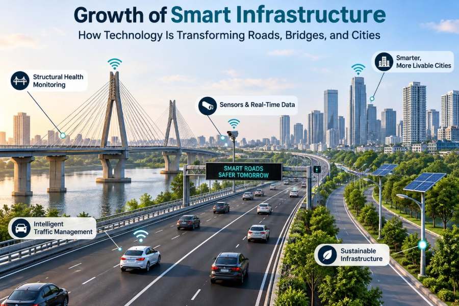

A commuter approaches a familiar intersection just as traffic begins to build. The signal changes earlier than expected, a bus receives priority, and the queue clears before it becomes a long delay. Elsewhere, a bridge inspector reviews a dashboard that flags an unusual vibration pattern before visible damage appears.
These are not scenes from a distant, fully automated city. They are examples of how digital tools are gradually being added to physical infrastructure that people already use every day: roads, bridges, drainage systems, street lighting, transit networks, and public spaces.
For civil engineers, the shift matters because infrastructure is no longer judged only by its original design capacity. It is increasingly expected to sense conditions, communicate useful information, adapt operations, and support better maintenance decisions throughout its service life.
Smart infrastructure does not mean placing sensors on everything. It means combining sound engineering fundamentals with appropriate data, communications, and operating practices to solve real problems safely and responsibly.
🏗️ What Smart Infrastructure Actually Means
Smart infrastructure is physical infrastructure that uses sensing, data, communication, automation, or digital models to improve how it is planned, operated, maintained, or renewed. The physical asset remains central; technology is an added capability, not a replacement for concrete, steel, soil, drainage, or good design.
A smart road may measure traffic speeds and adjust signal timing. A smart bridge may use strain gauges and accelerometers to track its behavior. A smart water network may identify pressure changes that suggest a leak.
The defining feature is a useful decision loop: observe conditions, interpret information, decide what action is appropriate, and verify the result.
🧱 Why the Physical Asset Still Comes First
A sensor cannot compensate for inadequate foundation capacity, poor compaction, corrosion-prone detailing, or an undersized drainage system. Digital systems work best when they are attached to assets with a clear design basis, accessible inspection points, and maintainable components.
This is a crucial distinction for students and project teams. Technology can reveal that a problem exists earlier, but it cannot make a structurally unsafe design safe. It may help engineers prioritize repairs, investigate causes, and monitor risk while a solution is developed.
Smart infrastructure should therefore be treated as part of the asset strategy, not as a decorative layer added at the end of construction.
📡 The Basic Technology Stack
Most systems have several connected layers. Sensors collect information from the asset or its surroundings. Networks transmit that information. Software stores, filters, and analyzes it. Finally, people or automated controls use the result to take action.
| Layer | Typical role | Example |
|---|---|---|
| Physical layer | Measures or controls real conditions | Strain gauge, camera, valve, signal controller |
| Communication layer | Moves data between field and platform | Fiber, cellular connection, radio network |
| Data layer | Stores, organizes, and checks information | Asset database, time-series data platform |
| Decision layer | Supports action by staff or systems | Maintenance alert, traffic-control algorithm |
A weak link can limit the entire system. Excellent sensors are of little value if their readings cannot be trusted, transmitted, interpreted, or acted upon.
📊 From Raw Data to Engineering Decisions
Data is not automatically insight. A bridge accelerometer produces a stream of numbers, but engineers need context: vehicle loading, temperature, wind, sensor location, baseline behavior, and the structure’s analytical model.
Data quality includes accuracy, completeness, timing, calibration status, and traceability. A missing or drifting sensor may create a misleading trend that looks like structural change.
Useful dashboards should answer practical questions: Has behavior changed? Is there a safety concern? Which inspection should be advanced? What evidence supports the decision? The goal is not simply to display more charts.
🛣️ Intelligent Transportation Systems on Roads
Intelligent transportation systems combine field devices, traffic management centers, road-user information, and control strategies. Common tools include traffic detectors, connected signal controllers, variable message signs, weather stations, and incident-detection cameras.
On a congested corridor, a system may identify a developing queue and modify signal coordination to reduce spillback into upstream intersections. In a work zone, it may warn drivers of changing lane conditions or reduced speeds.
These actions must be grounded in traffic engineering. A control strategy that improves one intersection can shift delay and risk to another if the corridor is not considered as a whole.
🚦 Adaptive Signals and Intersection Operations
Traditional traffic signals often use fixed timing plans based on expected patterns. Adaptive signal control uses observed traffic conditions to adjust selected timing parameters, such as green time or phase sequence, within defined safety rules.
It is especially useful where demand changes across the day, such as near stations, schools, event venues, or rapidly developing districts. Pedestrian crossing needs, bicycle movements, transit operations, and emergency access must remain part of the design.
A common mistake is to treat vehicle delay as the only performance measure. An intersection can move more cars while becoming less comfortable or less safe for people walking, cycling, or using mobility aids.
🚌 Transit Priority Without Ignoring Other Users
Transit signal priority can hold a green light briefly or call a phase earlier when a delayed bus or tram approaches. Done well, it can make public transport more reliable without requiring major reconstruction.
However, priority needs constraints. Frequent or unconditional requests can disrupt cross-street traffic, pedestrian intervals, and coordinated signals. Agencies need to define who qualifies, when a request is granted, and how performance will be monitored.
For example, priority may be limited to late vehicles, particular corridors, or times when passenger demand is highest. The best approach reflects local operating goals rather than applying a generic setting.
📷 Cameras, Detection, and the Limits of Seeing
Video analytics can estimate traffic volumes, detect stopped vehicles, identify blocked lanes, and support incident response. Radar, loops, and other detectors can provide similar operational data under different site conditions.
Yet a camera view is not a complete understanding of an event. Rain, glare, shadows, occlusion by large vehicles, poor placement, and communication outages can reduce reliability. Automated classifications also require validation against field observations.
Privacy should be considered from the beginning. Systems should collect only what is needed for the operational purpose, protect stored information, and define retention and access rules clearly.
🌉 Structural Health Monitoring for Bridges
Structural health monitoring, often shortened to SHM, uses measurements to observe a structure’s condition or behavior over time. Bridge systems may include strain sensors, displacement sensors, accelerometers, tilt meters, corrosion probes, temperature sensors, or weigh-in-motion equipment.
The central value is often trend detection. Engineers can compare current behavior with expected ranges and investigate changes that may reflect deterioration, altered loading, movement at bearings, or environmental effects.
SHM complements inspection; it does not eliminate it. Many defects remain visual, hidden inside components, intermittent, or beyond the reach of a particular sensor arrangement.
📐 Reading Bridge Measurements in Context
Bridge response changes naturally with temperature, traffic, wind, and seasonal conditions. Expansion and contraction, for instance, can produce movements that are normal but would look concerning if temperature were ignored.
Engineers therefore establish baselines and look for patterns rather than reacting to every isolated reading. A meaningful alert threshold should reflect the asset’s design, known behavior, sensor uncertainty, and consequences of missing a problem.
A hypothetical example is a bearing whose movement becomes progressively restricted across similar temperature cycles. That pattern may justify inspection, but it is not by itself a diagnosis; field examination is still needed.
🔧 Predictive Maintenance and Asset Management
Traditional maintenance often follows a fixed schedule or begins after a visible failure. Predictive maintenance uses condition data and operational history to identify where attention may be needed before a fault becomes disruptive.
For civil assets, prediction is rarely a simple countdown to failure. Pavement deterioration, corrosion, scour, and equipment wear depend on exposure, loading, construction quality, drainage, repair history, and local environment.
The practical benefit is better prioritization. Asset managers can direct limited inspection and renewal funds toward locations where the likely risk, consequence, and timing of deterioration justify intervention.
🕳️ Smart Pavements and Road Condition Monitoring
Road agencies can combine pavement surveys, vehicle data, weather records, maintenance history, and sometimes embedded sensors to understand pavement condition. Surface distress, roughness, rutting, skid resistance, and structural capacity each describe different aspects of performance.
A smartphone-based report of a pothole may help identify a local hazard, but it does not replace a network-level pavement assessment. Conversely, a high-level condition index may hide a localized defect that creates an immediate safety issue.
Good programs connect observations to treatments. Sealing cracks early, improving drainage, and repairing localized failures can often preserve value better than waiting until full-depth reconstruction is the only option.
🌧️ Weather Intelligence and Resilient Operations
Weather affects pavement friction, visibility, drainage, bridge movement, slope stability, and construction operations. Road weather information systems can combine local sensors with forecasts to support decisions on plowing, de-icing, warnings, closures, and inspection.
Real-time information is valuable, but it must be interpreted with uncertainty in mind. Conditions can vary across a route, particularly in mountainous terrain, coastal areas, shaded corridors, and urban heat islands.
For resilience, technology should support preplanned actions: checking vulnerable culverts, positioning crews, closing flood-prone routes when necessary, and communicating alternatives before conditions worsen.
💧 Smarter Water, Drainage, and Flood Control
Cities increasingly use level sensors, rainfall gauges, flow meters, and remotely operated gates to understand drainage performance. These tools can reveal rising water levels, blocked inlets, unusual pump operation, or pressure changes in water networks.
Urban flooding is not solved by a dashboard. It requires appropriate conveyance, storage, maintenance, land-use planning, and safe overflow routes. Sensors help operators see what is happening, but physical capacity and maintenance determine much of the outcome.
A well-designed system can also improve post-event learning by showing when and where water rose, which assets performed as expected, and where field inspections should focus.
💡 Connected Street Lighting and Public Space
Networked lighting can report lamp failures, energy use, electrical faults, and operating status. Some systems allow dimming schedules or localized adjustments while maintaining required visibility and safety conditions.
The engineering question is broader than energy use. Lighting affects pedestrian comfort, wayfinding, driver visibility, maintenance access, night-time work, and public perception of a place.
Controls should not create abrupt dark areas or compromise safety. Designers also need to consider glare, light spill, maintenance procedures, and compatibility with future replacement fixtures.
🏙️ Digital Twins for Infrastructure Systems
A digital twin is a digital representation linked, to varying degrees, with a real asset or system. It may combine drawings, geometry, inspection records, sensor data, maintenance history, and operational models.
Its usefulness depends on the question being asked. A bridge twin might help locate components, visualize inspection findings, and compare data over time. A city-scale model might test the likely operational effects of a road closure or development proposal.
Not every 3D model is a digital twin. If the information is outdated, disconnected from asset records, or too complex for staff to use, it may be visually impressive but operationally weak.
🧭 GIS as the Geographic Backbone
Geographic information systems, or GIS, connect assets and events to location. This matters because roads, pipes, signals, bridges, work orders, parcels, flood zones, and service boundaries all have spatial relationships.
A GIS map can help a maintenance team see whether repeated drainage complaints occur near the same low point, whether bridge inspection access conflicts with a trail, or which facilities may be affected by a planned closure.
Location data must be managed carefully. Inconsistent asset identifiers, inaccurate coordinates, and disconnected maps can undermine an otherwise capable digital program.
🚧 Construction Technology and Safer Delivery
Technology is changing construction as well as operations. Machine control can guide grading and excavation, drones can document progress where permitted, and digital field tools can connect inspection records, drawings, quantities, and requests for information.
These tools can reduce rework when they provide current, controlled information to the people doing the work. They can also expose problems earlier, such as a mismatch between installed work and design geometry.
They do not remove the need for survey control, competent supervision, quality testing, or safe work planning. A digital model with an incorrect coordinate system can spread error quickly and confidently.
🧩 Building Information Modeling Beyond Design
Building information modeling, or BIM, is often associated with design coordination. For infrastructure, its longer-term value can be in handing over structured information that supports construction, commissioning, operations, and renewal.
To achieve that value, owners must specify what information they actually need. Useful records may include component identifiers, material data, warranties, inspection requirements, test results, and maintenance access details.
Requiring every possible attribute creates a large, expensive dataset that may never be maintained. The better approach is to define information requirements around future decisions and assign responsibility for verification.
🔗 Interoperability: Making Systems Work Together
Infrastructure organizations often use separate systems for drawings, work orders, traffic operations, finance, inspections, GIS, and document control. Interoperability is the ability to exchange and use information across those systems without repeated manual re-entry.
Common asset IDs, data definitions, file formats, and governance rules are often more valuable than a single all-purpose platform. They reduce ambiguity when data moves from a design model to an operations record.
Procurement should avoid locking an owner into a vendor system that cannot reasonably export its own data. Technology choices change; an asset may remain in service for decades.
🔐 Cybersecurity Is a Public-Safety Issue
When digital systems influence signals, pumps, gates, lighting, or traffic messages, cybersecurity becomes part of infrastructure risk management. Unauthorized access, malware, weak passwords, and poorly managed remote connections can disrupt real-world services.
Basic controls matter: network segmentation, access permissions, software updates, backups, logging, vendor management, and rehearsed incident response. Operational technology should not automatically be treated like an ordinary office network.
Cybersecurity cannot guarantee that disruption will never occur. It can reduce exposure, improve detection, and help organizations restore safe operations more quickly when something goes wrong.
🔒 Privacy, Equity, and Public Trust
Smart-city systems can collect information about movement, service use, or conditions in public space. Even when the purpose is legitimate, agencies should be clear about what is collected, why it is needed, who can access it, and how long it is retained.
Equity also deserves attention. A smartphone-only parking system, a digital-only travel alert, or an algorithm trained on incomplete data may exclude people who lack devices, connectivity, language access, or reliable representation in the data.
Public trust grows when programs have understandable purposes, proportionate data collection, transparent governance, and accessible non-digital alternatives where they are needed.
⚖️ Automation Needs Human Accountability
Automation can perform repetitive tasks quickly, such as flagging unusual readings or adjusting signals within approved limits. It should not obscure who is responsible for safety-critical decisions.
Algorithms reflect their objectives, assumptions, inputs, and constraints. If a traffic tool is optimized only for vehicle throughput, it may unintentionally disadvantage pedestrians or transit users. If a maintenance model is trained on incomplete records, it may reproduce past reporting gaps.
Engineers and operators need the ability to review outputs, challenge recommendations, override systems safely, and document why significant decisions were made.
💰 Whole-Life Value Instead of Gadget Purchasing
The purchase price of a device is only one part of its cost. Sensors may require power, communication fees, calibration, protective enclosures, replacement parts, software licenses, cybersecurity updates, data storage, and staff time.
Before buying technology, define the decision it will improve and the value of improving it. A low-cost manual inspection may be better than continuous monitoring for a low-risk, accessible asset.
Lifecycle planning should include what happens when equipment reaches end of life. If a proprietary platform disappears or a sensor fails, the owner needs usable data and a realistic replacement path.
🧪 Pilot Projects That Produce Real Learning
Pilots are useful when they test a focused question under real operating conditions. A small trial might ask whether water-level sensors provide enough lead time to improve culvert inspections during intense rainfall.
A strong pilot defines baseline performance, responsibilities, data ownership, user training, success criteria, failure modes, and a decision point for scaling, changing, or stopping the program.
Installing devices without an evaluation plan creates a demonstration rather than a learning project. It can also leave staff responsible for maintaining equipment whose purpose was never confirmed.
🧰 Designing for Maintenance and Field Reality
Technology is often designed from a control room perspective, but field conditions determine whether it survives. Devices need safe access, weather protection, secure mounting, power, communications, clear labels, and maintainable replacement procedures.
A sensor installed where crews need lane closures or specialized access equipment for routine servicing may create more burden than benefit. Similarly, an alert is only useful if it reaches someone with authority and capacity to respond.
Involving inspectors, maintenance crews, operators, and emergency staff early exposes practical constraints that are easy to miss in a concept diagram.
📏 Standards, Validation, and Professional Judgment
Smart infrastructure operates within established engineering, accessibility, safety, environmental, procurement, and data-protection requirements. The exact rules vary by jurisdiction and asset type, so project teams must confirm applicable requirements rather than assume a technology is approved everywhere.
Validation should include installation checks, calibration, communications testing, data review, and operational scenarios. For safety-relevant applications, teams should define what happens if data is unavailable, implausible, delayed, or contradictory.
Professional judgment remains essential. A neatly presented indicator is not evidence by itself; it must be interpreted against the physical asset, design assumptions, and consequences of action or inaction.
🎓 Skills Civil Engineers Need to Build
Civil engineers do not need to become software specialists to contribute effectively, but they do need digital fluency. They should understand what a sensor measures, how uncertainty enters data, what a model assumes, and how information supports asset decisions.
Valuable capabilities include:
- asking clear operational questions before selecting technology;
- understanding basic data visualization, databases, and GIS;
- communicating with software, electrical, cybersecurity, and operations teams;
- connecting monitoring results to structural, geotechnical, hydraulic, or transportation principles;
- documenting limitations and making decisions traceable.
The most effective practitioners are often translators: they connect field reality, engineering analysis, digital systems, and public needs.
🤝 Collaboration Across Disciplines
Smart infrastructure projects rarely succeed through one discipline alone. Transportation engineers may define operations; structural engineers may interpret monitoring; electrical teams may provide power; IT staff may manage networks; planners may address public outcomes; and maintenance teams may keep the system functional.
Early collaboration prevents familiar failures, such as specifying a device without a power source, collecting data without an owner, or building a dashboard without a response procedure.
A shared concept of operations is especially helpful. It describes who uses the system, under what conditions, what actions they take, and how the system behaves when something fails.
🏘️ Smart Cities Are More Than Technology Platforms
A city becomes more capable when its services are coordinated around real needs: safe mobility, reliable water, healthy public space, accessible information, climate resilience, and efficient maintenance. Digital tools can support these goals, but they do not define them.
For example, a city may use data to identify dangerous crossing patterns. The appropriate response might be a signal change, but it might also be a shorter crossing distance, better lighting, slower vehicle speeds, or a redesigned street layout.
The technology should help leaders ask better questions about the built environment, not narrow solutions to whatever can be measured most easily.
🧠 A Practical Framework for Choosing Technology
Before committing to a smart-infrastructure system, project teams can work through a disciplined sequence:
- Define the physical problem and the decision that needs support.
- Establish the current condition or performance baseline.
- Consider non-digital design, maintenance, or policy solutions first.
- Select the simplest technology that provides reliable, actionable information.
- Plan power, communications, cybersecurity, ownership, maintenance, and training.
- Test performance, review outcomes, and adjust based on evidence.
This process avoids a common trap: buying a capability because it is available rather than because it improves a clearly defined public or engineering outcome.
🌱 The Core Principle: Better Decisions for Better Assets
The strongest case for smart infrastructure is not that every asset should be connected. It is that well-chosen information can help owners understand conditions sooner, operate systems more effectively, target maintenance more intelligently, and communicate more clearly with the public.
Its limitations are equally real. Data can be incomplete, technology can fail, algorithms can embed poor assumptions, and digital systems create costs and security responsibilities. Physical resilience, inspection, engineering judgment, and accountable governance remain indispensable.
When technology is selected for a defined purpose and integrated into the whole asset lifecycle, it becomes a practical civil-engineering tool rather than an isolated innovation.
Smart infrastructure succeeds when it makes roads, bridges, and cities safer, more reliable, more understandable, and easier to care for—not merely more connected. That is the standard worth designing toward. 🌉🏙️📡