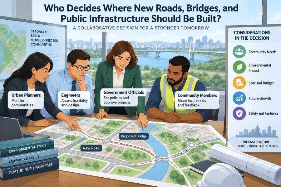

A growing suburb has one crowded road leading to schools, shops, and a hospital. Residents ask for a new bridge. A nearby town wants a bypass to move trucks away from its main street. A rural community needs safer access during floods. Each request sounds straightforward until one question appears: where, exactly, should the project go?
A line on a map can change travel times, property access, business activity, flood behaviour, habitat, and public budgets for decades. Building infrastructure is therefore not simply a matter of identifying an empty piece of land and starting construction.
Decisions about roads, bridges, transit lines, drainage systems, and utilities are made through a layered process involving public agencies, engineers, planners, elected officials, regulators, landowners, and community members. Their roles overlap, but they do not carry the same authority or responsibility.
Understanding that process helps civil engineering students see how technical design connects to public decisions. It also helps working professionals explain why a sensible-looking route may still be unsuitable—or why a difficult project may be necessary.
🧭 Infrastructure Location Is a Public Decision
Public infrastructure is placed to serve a defined need: moving people and freight, providing reliable water, reducing flood risk, connecting neighborhoods, or supporting emergency access. The location must work not only on opening day, but through changing traffic patterns, maintenance cycles, storms, and future development.
Unlike a private building project, a public road or bridge usually affects people beyond its direct users. That is why location decisions combine engineering evidence with public policy, funding rules, and legal responsibilities.
🏛️ Who Holds the Formal Authority?
The agency that owns, funds, or will operate the asset generally leads the decision. A municipal government may lead a local street project; a regional or state transportation agency may lead a highway; a national authority may be involved where strategic routes, navigable waters, or major funding programs are concerned.
Elected bodies commonly approve plans, budgets, and major commitments. Professional staff develop recommendations, manage studies, and administer contracts. The final structure differs by jurisdiction, so no single organization “decides everything.”
🗺️ Planning Comes Before Route Selection
A proposal should begin with a planning need, not a preferred alignment. For example, the need may be unreliable access to a growing district, recurring crash conflicts at a junction, or a bridge that no longer meets current load, clearance, or resilience requirements.
Long-range transportation and land-use plans identify broad corridors and priorities. They help agencies avoid constructing a road that conflicts with planned housing, protected land, future transit, or utility expansion.
📈 Demand Is Measured, Not Assumed
Traffic counts, travel-time observations, freight patterns, transit ridership, crash records, pedestrian activity, and population forecasts help define the problem. These data do not dictate a solution, but they test whether the claimed need is real and where it occurs.
A congested corridor does not automatically justify more lanes. The cause might be one poorly designed intersection, school drop-off activity, missing sidewalks, unreliable buses, or a land-use pattern that concentrates every trip at the same hour.
🏘️ Land Use Shapes the Need for Infrastructure
Roads and bridges respond to development patterns, but they also influence them. A new interchange can make distant land easier to develop; a rail station can support denser mixed-use development if local policies permit it.
Planners therefore examine zoning, approved development, employment areas, schools, hospitals, and redevelopment goals. A project that solves today’s access issue can create tomorrow’s infrastructure burden if growth is not considered.
👥 Communities Help Define the Actual Problem
Residents, businesses, freight operators, cyclists, emergency services, and accessibility advocates experience a network differently. Their input can reveal issues that maps and models miss: a dangerous crossing, seasonal queueing, a route used by ambulances, or a sidewalk that becomes impassable in winter.
Public engagement is most useful when it starts before a route is fixed. Asking people only to comment on a nearly final drawing can turn consultation into conflict management rather than problem solving.
🧑💼 Elected Officials Set Priorities
Mayors, councils, boards, legislators, and similar elected representatives make choices about public priorities and spending. They may decide whether a corridor study proceeds, whether local funds are committed, or which projects enter an approved capital program.
They should not substitute political preference for safety analysis or environmental review. However, infrastructure choices are inherently public choices: deciding whether to fund a bridge instead of drainage upgrades is a policy decision as well as a technical one.
🧰 Engineers Test What Can Actually Be Built
Civil engineers translate a broad need into feasible alternatives. They investigate terrain, geometry, soil conditions, drainage paths, traffic operations, structural demands, construction staging, utility conflicts, and long-term maintenance.
An alignment that looks short on a map may require deep foundations, extensive retaining walls, complicated utility relocations, or a bridge over unstable ground. Engineering feasibility is therefore much more than drawing a straight line.
🔍 The Feasibility Study Narrows the Options
A feasibility study asks whether several possible solutions can meet the project purpose at a reasonable level of risk and cost. Options might include upgrading an existing road, improving an intersection, adding transit service, rehabilitating a bridge, building a new crossing, or doing nothing beyond maintenance.
The “do nothing” or no-build condition is a benchmark, not a sign of neglect. It shows what is likely to happen if the proposed intervention is not made.
🛣️ A Corridor Is Not Yet a Final Alignment
Early planning often identifies a broad corridor—a zone within which a project could be located. A final alignment is the precise horizontal and vertical route, including intersections, ramps, retaining structures, drainage features, and property limits.
Keeping this distinction clear prevents premature certainty. A corridor can be reasonable while a particular centerline within it proves impractical after surveying, geotechnical work, or environmental investigations.
📐 Road Geometry Sets Hard Limits
Road design must accommodate design speed, sight distance, grades, curve radii, cross slopes, intersections, and users such as pedestrians, cyclists, buses, and heavy vehicles. These requirements constrain where a safe road can fit.
For instance, a route may avoid one property but create a sharp curve near a school entrance. Moving the road slightly may improve visibility while affecting drainage or requiring additional land. Location is often a chain of such trade-offs.
🌊 Hydrology Can Decide the Route
Water follows topography, not property lines. Engineers study watersheds, streams, floodplains, groundwater, culverts, and stormwater flow to understand how a road embankment or bridge approach will alter drainage.
A low-cost crossing at a narrow stream may be a poor choice if floodwater spreads widely across the valley. A longer bridge, larger opening, elevated roadway, or a different crossing point may better preserve flow and reduce flood-related closure risk.
🪨 Ground Conditions Affect Cost and Reliability
Geotechnical engineers investigate soil and rock strength, groundwater, settlement potential, slope stability, seismic conditions where relevant, and contaminated ground. Their findings influence foundation type, earthworks, retaining systems, and construction methods.
Ignoring poor ground early can produce major redesigns later. A route across soft soils is not automatically rejected, but its extra risk and life-cycle cost must be visible in the comparison.
🌿 Environmental Review Changes Designs
Environmental review identifies likely effects on wetlands, waterways, habitat, air quality, noise, heritage resources, and other protected or valued features. The required process and permits vary by place and project type.
Good review is not simply a final approval hurdle. It can shift a route, change a bridge span, add wildlife crossings, reduce construction impacts, or establish monitoring and mitigation requirements.
🦌 Avoid, Minimize, Then Mitigate
A common decision sequence is to avoid sensitive impacts where practicable, minimize impacts that cannot be avoided, and mitigate remaining effects. This hierarchy encourages agencies to question the route before relying on compensation or post-construction measures.
For example, moving a roadway away from a wetland may be preferable to filling part of it and promising replacement elsewhere. The best outcome depends on site conditions, legal requirements, and the alternatives genuinely available.
🏠 Property and Displacement Must Be Taken Seriously
New infrastructure may require land acquisition, easements, access changes, or relocation of homes and businesses. These are not minor map edits; they affect livelihoods, community ties, and trust in the project process.
Agencies must follow applicable acquisition and compensation rules, but respectful communication matters as well. Early, clear information about uncertainty, timing, and access arrangements is better than leaving affected people to infer consequences from a concept plan.
⚖️ Equity Is Part of Sound Decision-Making
Benefits and burdens are rarely distributed evenly. A bypass may reduce through-traffic in one neighborhood while bringing noise or property impacts to another. A new station may improve access for many residents but be unusable for someone without a safe walking route.
Equity analysis asks who benefits, who bears disruption, who can participate, and whether alternatives create avoidable disparities. It does not mean every impact can be eliminated; it means impacts should be identified and considered openly.
🚑 Safety and Emergency Resilience Matter
Location decisions examine crash history, conflict points, evacuation routes, emergency response times, bridge redundancy, and likely failure modes during floods, earthquakes, fires, or severe weather. A network with only one access road may be vulnerable even if it operates acceptably on ordinary days.
Resilience is not always achieved by building something larger. It may come from protecting a critical culvert, creating a second emergency connection, strengthening a bridge, or designing a route that remains operable during predictable flooding.
🔌 Utilities Often Control Construction Complexity
Water mains, sewers, power lines, telecommunications cables, gas lines, and pipelines may occupy the most convenient corridor. Relocating them requires coordination with owners, design verification, permits, outages, and careful sequencing.
A route with fewer visible obstacles may hide major underground conflicts. Early utility mapping and field verification reduce the risk of discovering expensive surprises after design is advanced.
💰 Capital Cost Is Only One Part of Value
Decision-makers compare land, design, construction, mitigation, utility relocation, and contingency costs. Yet a cheaper initial option may cost more over time if it requires frequent repairs, has difficult access for maintenance, or is vulnerable to repeated closures.
Life-cycle cost considers the asset from construction through operation, renewal, and eventual replacement. It is especially relevant for bridges, drainage structures, pavement systems, and mechanical equipment with long service lives.
📊 Comparing Alternatives Transparently
Agencies often use a comparison matrix to assess options against the same criteria. The scores are aids to judgment, not machines that produce a politically neutral answer; assumptions and weighting still matter.
| Criterion | Question being tested | Typical evidence |
|---|---|---|
| Safety | Will conflicts and exposure be reduced? | Crash patterns, geometry review, access analysis |
| Mobility | Does it improve reliable movement? | Traffic, transit, freight, walking, and cycling analysis |
| Environment | What impacts remain after avoidance? | Field surveys, drainage and noise assessments |
| Cost and delivery | Can it be funded and built realistically? | Estimates, utility data, geotechnical risk, schedule review |
🗣️ Public Consultation Is More Than a Meeting
Effective engagement uses accessible drawings, plain language, multiple ways to participate, and feedback at decision points. It should explain what is open for discussion, what constraints are fixed, and how comments will be considered.
Technical teams should also explain trade-offs honestly. A public preference for a route may reveal a valuable local concern, but it cannot remove a floodplain, eliminate a required curve radius, or make an unaffordable structure inexpensive.
📜 Permits and Approvals Create Checkpoints
Major projects may require planning approvals, environmental permits, waterway permissions, heritage review, land-use changes, and funding authorization. These checkpoints test whether the project complies with applicable rules before irreversible commitments are made.
Approval does not prove that a project is universally popular or risk-free. It means the project has met the relevant decision requirements, often with conditions that must be carried into design and construction.
🏗️ Constructability Can Change the Best Option
Construction engineers consider work zones, temporary traffic routing, access for cranes and equipment, material supply, seasonal restrictions, worker safety, and the need to keep existing services operating. A design that is elegant in permanent condition may be extremely disruptive to build.
For a bridge replacement, building beside the existing bridge may preserve traffic but require more land and river work. Closing the route may shorten construction yet impose large detours. Neither choice is automatically right.
🔄 Phasing Keeps Projects Adaptable
Some needs are best addressed in stages. An agency might first improve a dangerous intersection, preserve land for a future corridor, add transit priority, and build a larger crossing only if growth and demand justify it.
Phasing reduces the risk of overbuilding, but it should not make later work needlessly difficult. Early stages need enough foresight to avoid blocking future drainage, access, or structural connections.
🚫 Common Mistakes in Location Decisions
- Starting with a favored route: this encourages evidence to be used defensively rather than comparatively.
- Treating travel time as the only outcome: safety, access, resilience, and community impacts can be equally consequential.
- Using outdated base information: new development, utilities, and site conditions can invalidate an old concept.
- Engaging affected people too late: late feedback often exposes issues when changes are most expensive.
- Underestimating maintenance: difficult access and poor drainage can turn a low-bid solution into a costly asset.
🧑🎓 What Civil Engineers Contribute
Civil engineers do not usually make location decisions alone, but they make better decisions possible. Their work turns broad objectives into evidence: feasible geometry, realistic quantities, drainage behaviour, structural options, risk registers, and clear explanations of uncertainty.
For students, the key lesson is that technical competence includes communication and context. A strong calculation is essential, but it must be connected to people, place, regulations, operations, and the client’s public responsibilities.
🤝 The Core Principle: Build the Right Project in the Right Place
There is rarely a perfect site or route. The strongest decision process defines the problem clearly, considers credible alternatives, tests them with sound engineering and local knowledge, discloses trade-offs, and records why a choice was made.
That process protects more than a project schedule. It helps create infrastructure that is safer to use, practical to maintain, more resilient to change, and more likely to retain public confidence over its full life.
New roads, bridges, and public works should be located through transparent decisions that balance need, engineering reality, environmental care, cost, and the people who live with the result. That balance is where civil engineering becomes public service. 🌉🧭🏗️